Density of cargo vessel transits, expressed in kilometres per squared kilometre, within the spatial reference EPSG: 3035 at a 10km spatial resolution and including the INSPIRE compliant cell identifier. Transit distance was calculated from the CIMA Foundation's AIS dynamic point data which was recorded from an antennae located at 44.30°N and 8.45°E between May 2013 and October 2014. After an initial preparation, cleaning and filtering procedure a GIS platform was used to create line transits from the positional points for each unique vessel for each day. The length of the cargo vessel transits were then summed within each grid cell for total and monthly composites covering the North West Mediterranean Sea.
Density of passenger vessel transits, expressed in kilometres per squared kilometre, within the spatial reference EPSG: 3035 at a 10km spatial resolution and including the INSPIRE compliant cell identifier. Transit distance was calculated from the CIMA foundations AIS dynamic point data which was recorded from an antennae located at 44.30°N and 8.45°E between May 2013 and October 2014. After an initial preparation, cleaning and filtering procedure a GIS platform was used to create line transits from the positional points for each unique vessel for each day. The length of the passenger vessel transits were then summed within each grid cell for total and monthly composites covering the North West Mediterranean Sea.
Density of service vessel transits, expressed in kilometres per squared kilometre, within the spatial reference EPSG: 3035 at a 10km spatial resolution and including the INSPIRE compliant cell identifier. Transit distance was calculated from the CIMA foundations AIS dynamic point data which was recorded from an antennae located at 44.30°N and 8.45°E between May 2013 and October 2014. After an initial preparation, cleaning and filtering procedure a GIS platform was used to create line transits from the positional points for each unique vessel for each day. The length of the transits were then summed within each grid cell for total and monthly composites covering the North West Mediterranean Sea.
Density of tanker vessel transits, expressed in kilometres per squared kilometre, within the spatial reference EPSG: 3035 at a 10km spatial resolution and including the INSPIRE compliant cell identifier. Transit distance was calculated from the CIMA foundations AIS dynamic point data which was recorded from an antennae located at 44.30°N and 8.45°E between May 2013 and October 2014. After an initial preparation, cleaning and filtering procedure a GIS platform was used to create line transits from the positional points for each unique vessel for each day. The length of the tanker vessel transits were then summed within each grid cell for total and monthly composites covering the North West Mediterranean Sea.
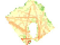
The mean speed in kilometres per hour and knots of all the combined shipping transits that traverse each grid cell and the number of transits within 4 (5 to 10, 10 to 15, 15 to 20 and 20knts and above) speed classifications. The shipping transits were calculated from the AIS dynamic point data which was recorded from an antenna located at 4430°N and 8.45°E between May 2013 and October 2014. Both shape files were created in spatial reference system EPSG: 3035, so that the number of transits and the attributes of the transits could be summarized into each cell in a GIS platform using spatial analysis.